Wildlife Habitat Analysis Tool
Help reduce impacts to wildlife and their habitats
The Utah Division of Wildlife Resources is constantly collecting data to support wildlife management and conservation efforts statewide. The DWR's new, free Wildlife Habitat Analysis Tool streamlines access to this data, helping natural resource specialists, land developers and others make informed, data-driven decisions.
The Wildlife Habitat Analysis Tool is a one-stop shop for authoritative Utah wildlife and plant species information. WHAT's robust analysis aids efforts such as:
- Project site selection
- Habitat restoration
- Land conservation
- Prevention of listing under the Endangered Species Act
- Sustainable trail design
- Improvements to wildlife migration
Using WHAT, you can perform a dynamic analysis of a land area using the satellite-based map interface, or you can generate a static analysis as a PDF file. We'll show you how to do both in the instructions below.
How to use the Wildlife Habitat Analysis Tool
Note: A UtahID is required to use the tool and access conservation data. Follow these instructions to create a UtahID.
-
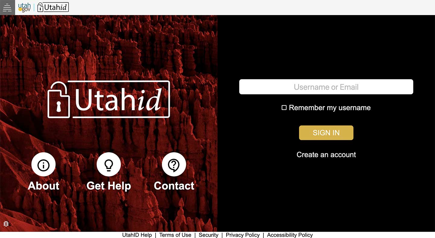
To access the Wildlife Habitat Analysis Tool, browse to what.wildlife.utah.gov on your desktop or mobile device. You will be prompted to sign in with your UtahID.
-
Once you've signed into WHAT, you'll see a list of your current projects:
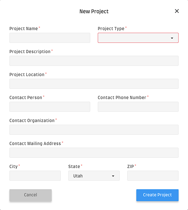
To start a new project, tap or click the "Create New Project" button.

Fill out all of the project details in the "New Project" window, and then tap or click "Create Project."
-
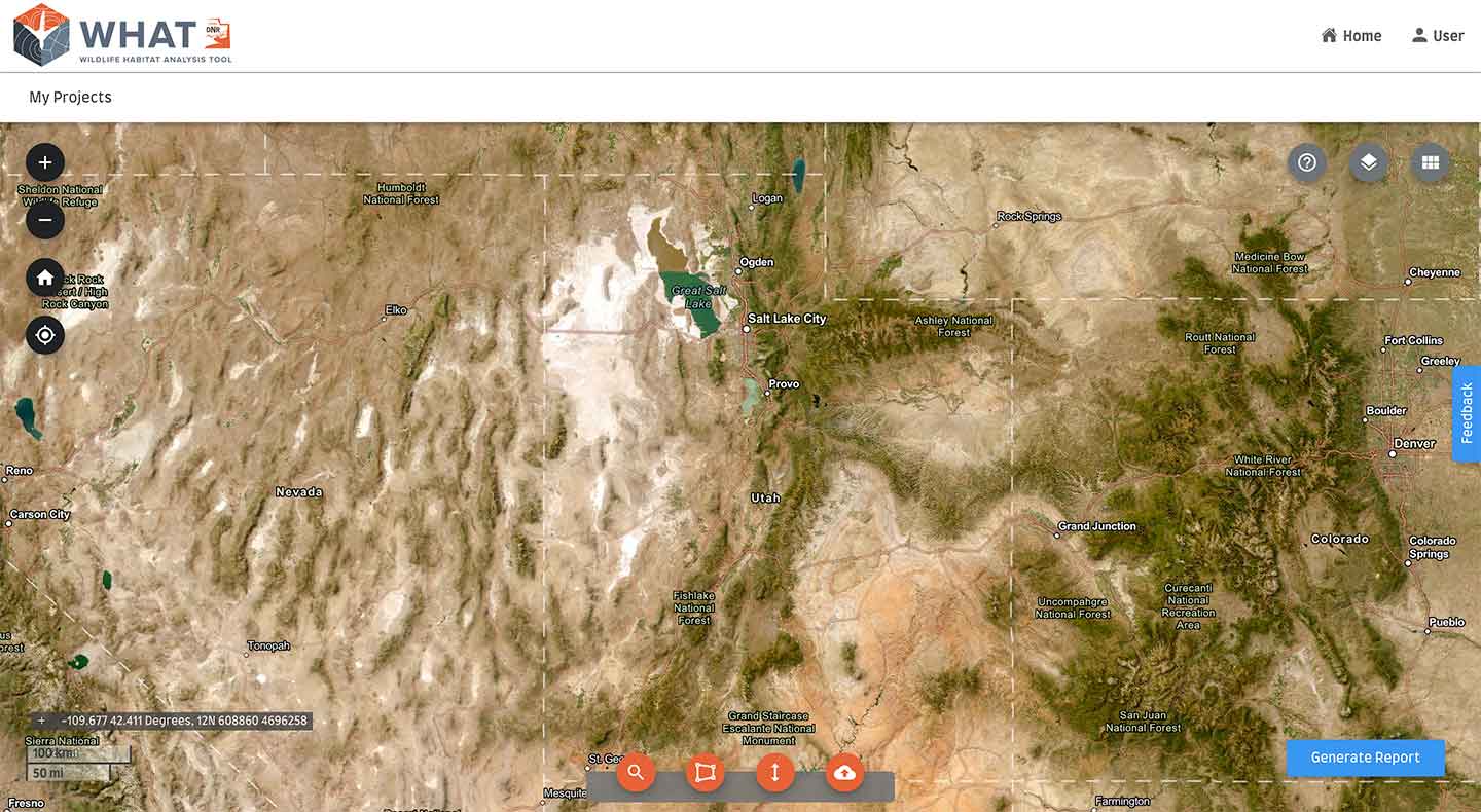
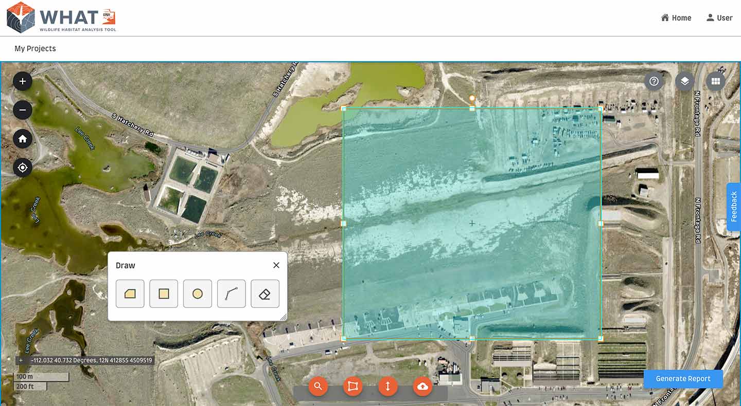
Now you'll see a satellite-based map of Utah and the surrounding states:
By default, an imagery map with labels is shown. You may zoom in and out using either the
 /
/ controls on the left or by pinching the touch interface of your device.
A brief tutorial that reviews each of the map screen controls is available by clicking the "Help" icon (
 ) in the upper right corner.
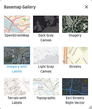
If you wish to change the map layer, click the grid menu icon (
 ) in the upper right corner to open the Basemap Gallery.
 -
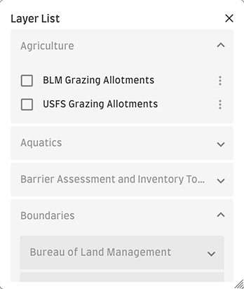
Use the Layer List (click the layers icon [
 ]) to display various land features, including:
- Grazing allotments
- Locations of fish hatcheries
- Boundaries of cities/towns, state lands and federal lands
- Habitats of many wildlife and fish species
- Land ownership information
- Migration corridors
- Your uploaded custom layers
-
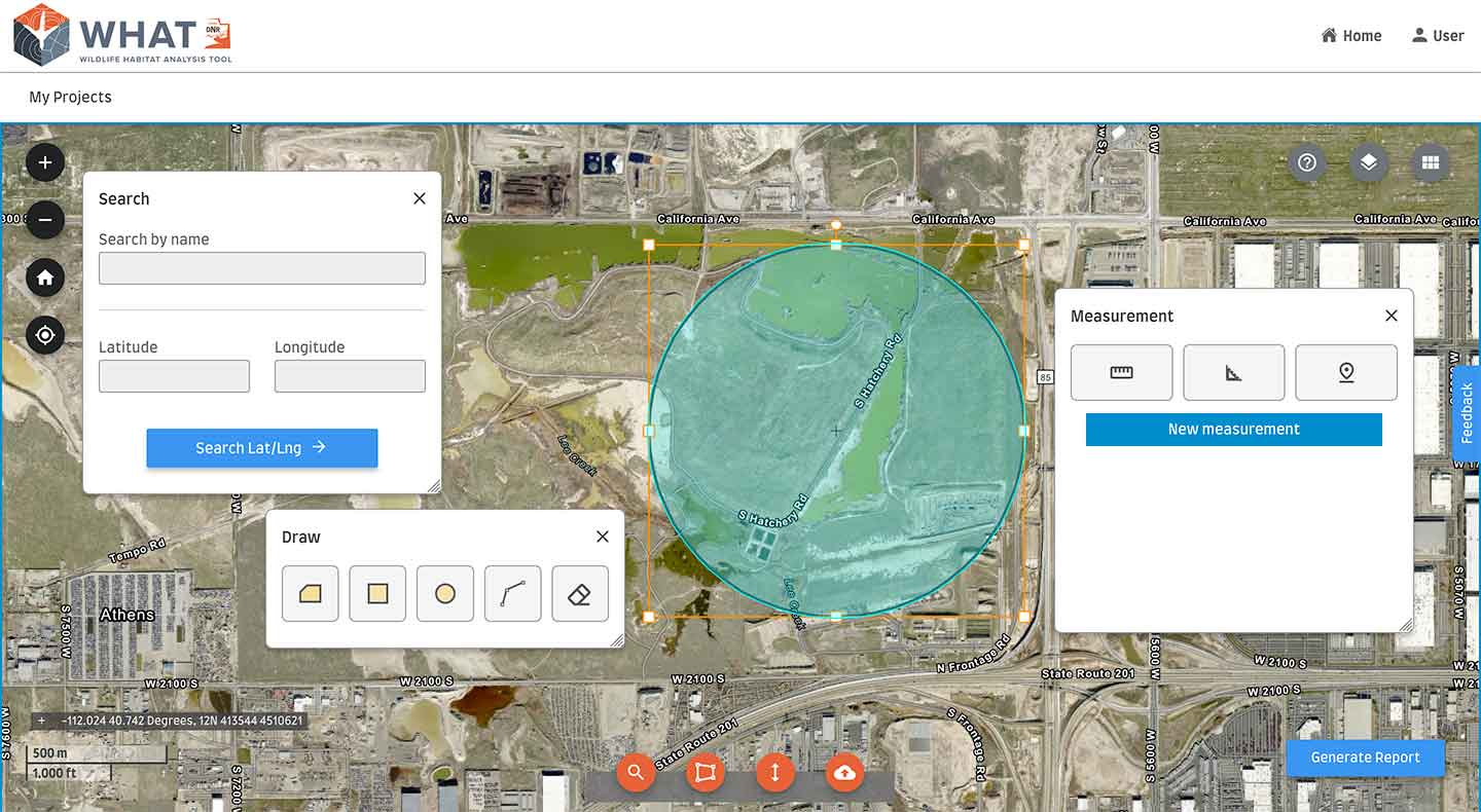
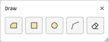
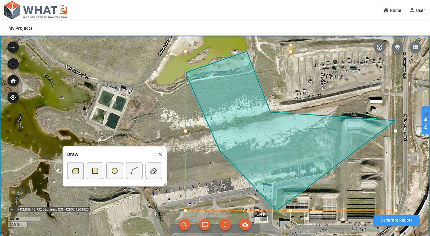
To mark an area on the map that you wish to analyze, zoom to the area and then click the "Draw" icon (
 ) to open the Draw tools:
On the Draw panel, click the shape (polygon, rectangle, circle or polyline) you would like to use, and then click on the screen to draw the shape. Use the edge handles to stretch, skew or rotate the shape.
In the case of a polygon or polyline, click for each point of the shape, and then double-click to complete the shape.
You may also apply a custom shape by clicking the "Upload File" icon (
 ) and uploading a shape file. Accepted file formats include zipped shapefile, KML, KMZ, GEOJSON and CSV.
To clear the shapes you've drawn, click the "Clear" button (
 ).
). -
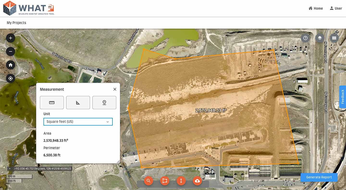
Use the "Measurement" tools (click the "Measurement" icon [
 ]) to determine distance, area and latitude/longitude.
 -
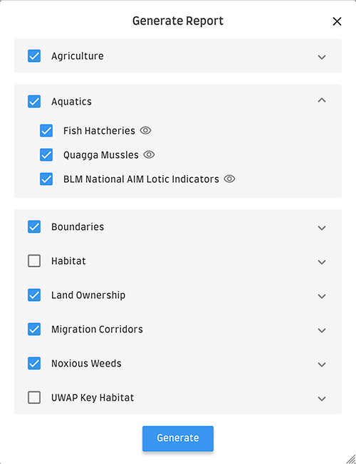
To generate a static habitat report of the project area you've marked on the map, click the "Generate Report" button.

Select all the layer options you wish to include (same options as the "Layer List"), and then click "Generate."
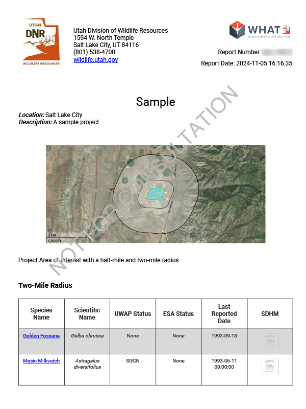
A PDF file will be created in your browser window and also emailed to you; the amount of time it takes to create this file depends on how big your land area is and how many options you've selected.
The report will include, in addition to detailed information about the layer options you've selected, tables of plants and animals (with state and federal status) found within at least a half-mile radius of your project area, as well as species information from the Utah Field Guide the Utah Wildlife Action Plan. Contact information of the closest DWR regional office and the local DWR biologist is also included.
Once the report is generated, the project will be marked completed in your projects list.
If you have any issues with WHAT or if you would like to offer any feedback on the tool, click the "Feedback" tab on the right to open the feedback form.


